Table of Contents
- 1. The Master Key: Decoding the Madaba Mosaic Map
- 1.1. The Oldest Map of the Holy Land
- 2. How Researchers Found the Lost Settlement
- 3. Anatomy of a Holy Rest Stop: Inside the Ruins
- 3.1. The Byzantine Basilica
- 4. An Economically Independent Oasis
- 5. A Strategic Trading Powerhouse
- 6. Life, Death, and the Shift to Islamic Rule
- 6.1. Voices from the Past
- 7. A Race Against Time: The Threat of Modernization
- 8. Frequently Asked Questions
- 8.1. What is the Madaba Mosaic Map and how did it help archaeologists?
- 8.2. Where exactly is the lost town of Tharais located?
- 8.3. What kind of buildings have been uncovered at the site?
- 8.4. Why did the inhabitants eventually abandon Tharais?
- 8.5. Why is the archaeological site currently in danger?
Lost Byzantine Town Found in Jordan Unlocks Early Christian Secrets
After slipping into complete obscurity for more than a millennium, a major holy site from the dawn of Christendom has finally been pulled from the sands of time. Archaeologists in southern Jordan have officially located the lost Byzantine town of Tharais—an ancient settlement whose existence was known only through a famous 1,500-year-old mosaic map, but whose physical coordinates had baffled explorers for generations.
The monumental discovery, spearheaded by a dedicated research team, promises to radically reshape our understanding of early Christian communities, ancient trade networks, and daily economic life in the Middle East during a time of immense religious transition.
Lost Byzantine Town Found in Jordan Unlocks Early Christian Secrets
The Master Key: Decoding the Madaba Mosaic Map
For decades, the primary evidence that Tharais ever existed sat on the floor of a historic church miles away. The breakthrough discovery was made possible by studying the world-renowned Madaba Mosaic Map.
The Oldest Map of the Holy Land
Housed inside the Greek Orthodox Church of St. George in Madaba, Jordan, this stunning sixth-century floor mosaic is the oldest surviving geographic map of the Holy Land. Among its intricate depictions of ancient cities, rivers, and landmarks, the map explicitly labels the town of Tharais (written in ancient Greek as Θαραίς) alongside famous biblical localities like Al-Karak and Zoar.
[ Ancient Mosaic Geography ]
 Madaba Map Location:  Al-Karak ─── Zoar ─── [ Tharais ]
Despite its prominent placement on the map—which signaled to historians that the town was a location of significant importance—the actual ruins of Tharais remained entirely missing. Countless previous scholarly expeditions misidentified the location, searching in the wrong valleys and plateaus for generations.

How Researchers Found the Lost Settlement
The successful effort to pinpoint the exact location was led by Dr. Musallam R. Al-Rawahneh, an Associate Professor of Archaeology at Mu’tah University. Between 2021 and 2024, Dr. Al-Rawahneh coordinated an intense campaign that combined modern field surveys, exhaustive analysis of centuries-old historical texts, and invaluable geographical insights provided by local residents.
The breakthrough came when researchers noticed a massive, unexplained concentration of authentic Byzantine-era pottery shards and cut building stones littering the landscape near the contemporary village of El-ʿIrāq, located within Jordan’s rugged Karak Governorate. Targeted excavations quickly proved that this was indeed the long-lost settlement featured on the Madaba Map.
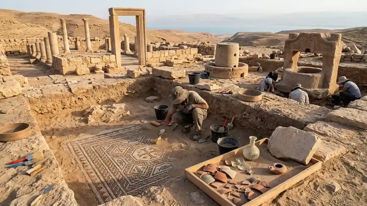
Anatomy of a Holy Rest Stop: Inside the Ruins
Publishing his team’s findings in the scientific journal Gephyra, Dr. Al-Rawahneh explained that Tharais was far more than a simple, isolated farming hamlet. The architectural scale of the ruins indicates that it operated simultaneously as an agricultural hub, a sacred destination for religious pilgrims, and a bustling commercial rest stop.
The Byzantine Basilica
At the heart of the newly uncovered town sits the unmistakable foundation of a grand Byzantine basilica-style church. The archaeological team carefully excavated the core structural elements of this ancient house of worship, discovering:
Intricate Mosaic Floors: Fractured but beautifully colored pieces of mosaic tile work that once adorned the church aisles.
Monumental Doorways: A heavy, rectangular stone entrance frame that served as the primary threshold for ancient worshippers.
Architectural Parallels: The masonry techniques and threshold stones perfectly mirror the engineering styles utilized in other major 5th- and 6th-century religious buildings across the Byzantine Empire.
An Economically Independent Oasis
While the basilica highlights the spiritual life of Tharais, the surrounding ruins reveal an incredibly sophisticated and self-sufficient local economy. The town was built to thrive independently, utilizing the natural resources of the landscape to generate substantial wealth.
Directly adjacent to the religious complex, archaeologists uncovered an expansive industrial sector dedicated to food and trade production. The team unearthed a heavy, cylindrical stone olive oil press, a massive structural layout for a grape press used in winemaking, and the preserved remnants of an ancient watermill.
These industrial finds prove that the citizens of Tharais were mass-producing valuable liquid commodities—oil and wine—which were highly sought after across the Mediterranean world.
A Strategic Trading Powerhouse
The physical layout of Tharais was dictated by its highly profitable geography. Nestled strategically between the towering Moabite Plateau and the southeastern rim of the Dead Sea, the town sat directly atop a critical commercial highway.
This specific corridor connected the ancient oasis city of Zoar (modern-day Ghor es-Safi) with the major urban centers of central Jordan. By serving as a secure, well-watered waypoint where international merchant caravans could rest, trade, and pray, Tharais elevated itself into a crucial economic linchpin for the Byzantine authorities in the region.
Life, Death, and the Shift to Islamic Rule
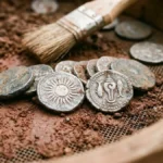
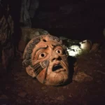
Beyond the heavy stones of the church and factories, the dirt of Tharais yielded a vast array of smaller, deeply personal artifacts that tell the story of the people who lived there. The excavation team recovered a treasure trove of domestic items, including delicate glass vessels, everyday pottery utensils, and prehistoric fossils collected by the town’s inhabitants.
Voices from the Past
Crucially, the site yielded numerous Greek and Latin funerary inscriptions carved into tombstones dating from the fifth to the seventh centuries CE. Dr. Al-Rawahneh noted that these inscriptions frequently feature distinct Christian imagery, prayers, and cultural references, providing undeniable, tangible proof of a deeply rooted, literate Christian population living continuously in the valley.
Why Was Tharais Abandoned?
The artifacts reveal that the town was occupied from the Roman period straight through to the early Islamic era. However, by the 7th century CE, the vibrant community went completely silent. Evidence suggests a combination of destructive regional earthquakes, severe shifts in local climate patterns, and the sweeping geopolitical transition from Byzantine imperial administration to Islamic rule caused the population to gradually abandon the site, leaving it to be safely buried under protective layers of sediment for hundreds of years.
A Race Against Time: The Threat of Modernization
While the rediscovery of Tharais is a triumph for global archaeology, its long-term survival is far from guaranteed. The ruins sit dangerously close to the rapidly expanding borders of modern El-ʿIrāq.
As modern infrastructure, residential housing, and urbanization encroach upon the archaeological borders, experts fear that unexcavated portions of this invaluable town could be accidentally bulldozed and permanently lost to history. Ongoing surveys and aggressive preservation efforts are urgently required to fully map the trade networks, everyday domestic lives, and religious evolution of this newly reborn Byzantine treasure before modern development erases it forever.
Frequently Asked Questions
What is the Madaba Mosaic Map and how did it help archaeologists?
The Madaba Mosaic Map is a 1,500-year-old floor mosaic located inside the Church of St. George in Madaba, Jordan. It is the oldest known geographic map of the Holy Land. It helped archaeologists because it explicitly labeled and illustrated the lost town of Tharais, confirming its historical existence and providing clues to its general region.
Where exactly is the lost town of Tharais located?
The ancient ruins of Tharais were discovered in southern Jordan, specifically near the modern-day village of El-ʿIrāq within the Karak Governorate. Geographically, it sits in a strategic zone between the Moabite Plateau and the southeastern edge of the Dead Sea.
What kind of buildings have been uncovered at the site?
Archaeologists have uncovered the clear foundations of a large Byzantine basilica-type church, complete with mosaic floor fragments and stone entry frames. They also discovered major agricultural processing structures, including an olive oil press, a large grape press for wine production, and a historic watermill.
Why did the inhabitants eventually abandon Tharais?
The town was gradually abandoned around the 7th century CE. Archaeologists attribute its decline to a combination of severe regional earthquakes, changing climate conditions that impacted farming, and the widespread societal adjustments that occurred during the geopolitical shift from Byzantine to Islamic rule.
Why is the archaeological site currently in danger?
The site is at risk due to modern urbanization. The neighboring village of El-ʿIrāq is expanding rapidly, and archaeologists are concerned that encroaching modern construction, roads, and housing developments could destroy unexcavated historical evidence before it can be studied.